DRC: Conserving community forests
Location
South-Kivu Province, eastern Democratic Republic of the Congo (DRC)
Goal
Advance the conservation of Grauer’s gorilla and other threatened species in the eastern Congo Basin.
Project Field Partner
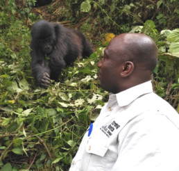
Founded in 2009, Strong Roots is a community-based organization working at the nexus of conservation and sustainable development. They work with communities who live on the borders of Protected Areas and those living in community forests.
Size of Area Involved
6,000 km²
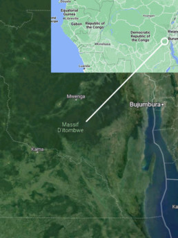
A wealth of life along the rift
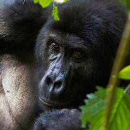
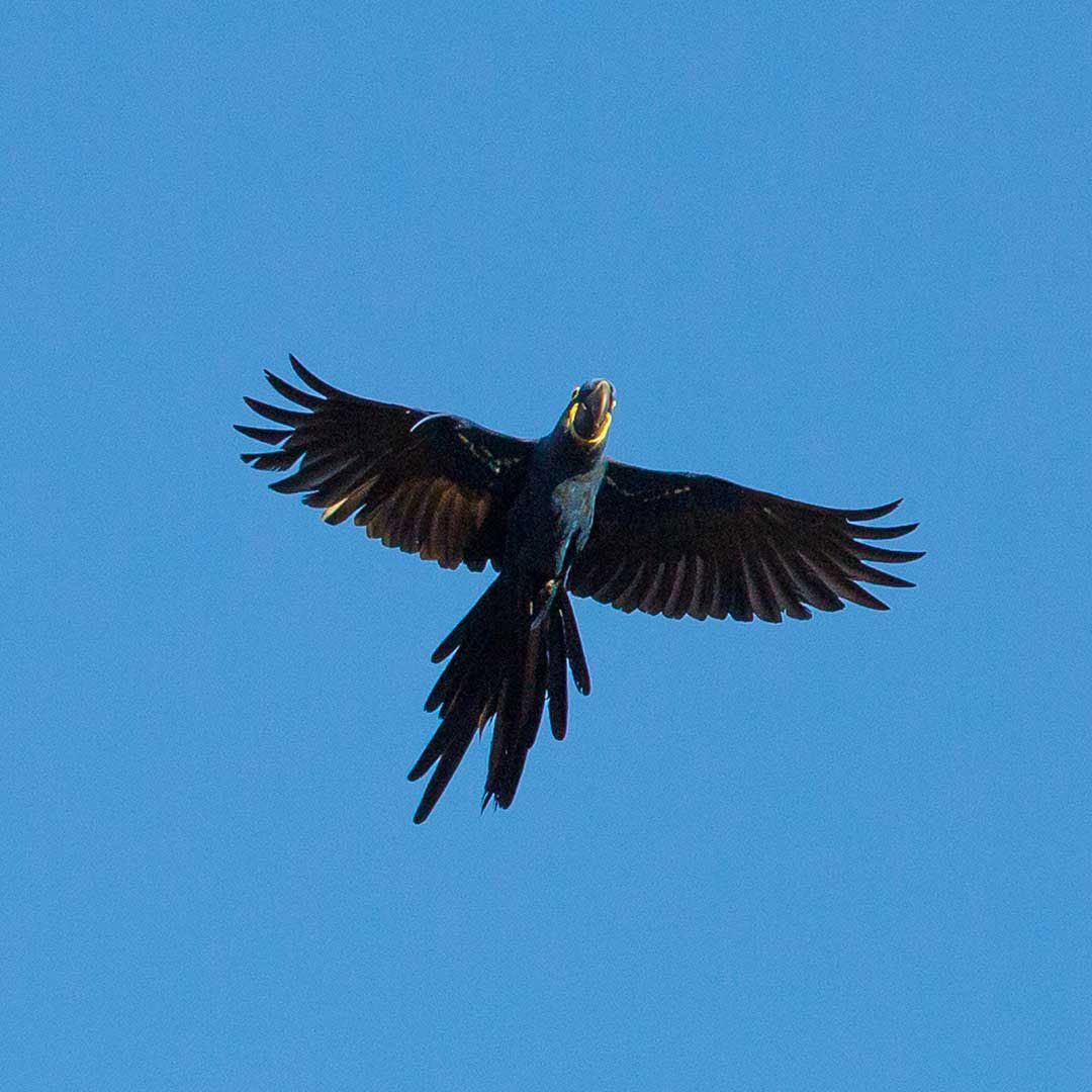
Grauer’s Gorilla (Gorilla beringei graueri), endemic to the Albertine Rift escarpment in eastern Democratic Republic of Congo, has suffered a rapid population decline (70%) in the last 20 years. It is now listed as Critically Endangered (CR) in the IUCN Red List. The rich biodiversity of the area includes the Itombwe Massif Clawed Frog (CR), Prigogine’s Nightjar (EN), Prigogine’s Greenbul (EN), Chimpanzee (EN), Congo bay-owl (EN), Itombwe Golden Frog (EN), Yellow-crested Helmet-shrike (VU), and African Forest Elephants (CR).

Threats:
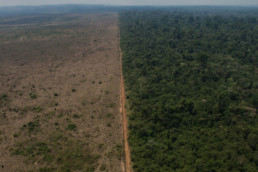
Primates in the DRC are primarily threatened by the mining of precious minerals at artisanal and industrial scale, poaching and pollution of soil and ground water. Mining is the main driver of armed conflict in the region and stimulates human migration, wildlife trafficking, illegal logging for charcoal, colonization of forested areas, bushmeat hunting, and the construction of temporary roads in the forests. The extreme poverty in the region and the communities’ reliance on slash-and-burn agriculture are also drivers of great ape habitat degradation and fragmentation. All of this has led to a rapid population decline of Grauer’s gorilla from an estimated 16,900 individuals in the wild in the mid-1990s to fewer than 3,800 individuals today.
However, recent surveys conducted by the Wildlife Conservation Society and the Congolese Wildlife Authority show an 18% increase in Grauer’s Gorilla numbers in the high-altitude sector of Tshivanga in Kahuzi-Biega National Park resulting from conservation efforts by organizations such as field partner Strong Roots and the increased presence of the Congolese Wildlife Authority. This shows what is possible.
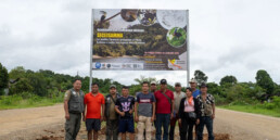
Constructing a biological corridor
In August 2022 years of work by Strong Roots and the communities succeeded in getting approval for thirteen officially designated Forestry Concessions for Local Communities (CFCL) covering over a quarter million hectares. This is a phenomenal achievement! Six more CFCLs await approval.
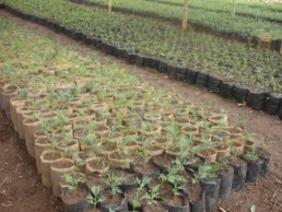
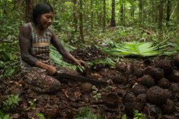
This is part of an ambitious plan to empower local communities and indigenous peoples to manage and protect their traditional lands. This forms part of a ~6,000-km² biological corridor connecting Parc National de Kahuzi-Biega to the Réserve Naturelle d’Itombwe. Crucially, the project will benefit local communities beyond simply giving them control of their forests. Strong Roots works with communities to develop sustainable livelihoods such as climate-smart agriculture and beekeeping.
Eventually community members will be included in great ape monitoring and patrolling and reforestation in the corridor area with agroforestry and native tree species. At last count, 4,212 households are direct beneficiaries of the project—people involved in carrying out its programs. These encompass 129 clans, 7 Chiefdoms, in 333 villages.
The Kayapo Project
Location
South-East Amazonia, Brazil
Goal
The Kayapo Project is an Indigenous led NGO alliance ensuring Mebêngôkre-Kayapo (Kayapo) cultural, economic, political, and territorial autonomy over more than nine million hectares of federally demarcated Indigenous lands located in the highly threatened southeastern Amazon.
Project Field Partner
ICF partners with three Kayapo NGOs: the Protected Forest Association, Kabu Institute, and Raoni Institute representing communities of the northeast, northwest and southwest sectors of Kayapo territory.
Size of Area Involved
~9 million hectares, 90,000km2. Approximately the size of South Korea, the State of Virginia, 3x the size of Belgium
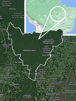
Maps data © 2024 Google
Kayapo lands conserve the last remaining large, intact block of native forest in the southeastern Amazon, and maintain the connectivity of this ecoregion with the western Amazon. They confer incalculable benefits to protection of biodiversity, mitigation of climate change and preservation of the crucial role of Amazonian forests in producing rainfall over a much larger geographic scale.
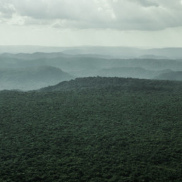
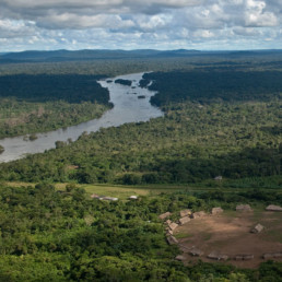
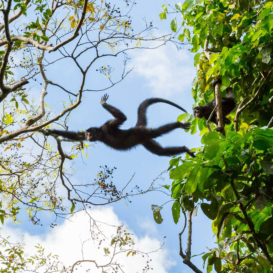
Kayapo territories are large enough to protect large scale ecological processes. For example, very large areas are required to maintain tropical tree species because individuals of species are usually very sparsely distributed. Most tropical tree species depend on co-evolved animal vectors for pollination and seed dispersal across large inter-individual distances – small areas do not contain enough individuals or viable animal vector populations for regeneration over the long term. The intricate web of interdependence among Amazonian species requires large areas for these ecosystems to function and persist.
Threatened vertebrate species found in the Xingu protected areas corridor, with IUCN Red List (2016) designation.
Endangered species:
Eastern Amazonian Bearded Saki Monkey (Chiropotes satanas utahicki) Critically Endangered
White-cheeked Spider Monkey (Ateles marginatus) Endangered
Giant Otter (Pteronura brasiliensis) Endangered
Vulnerable or Near Threatened species:
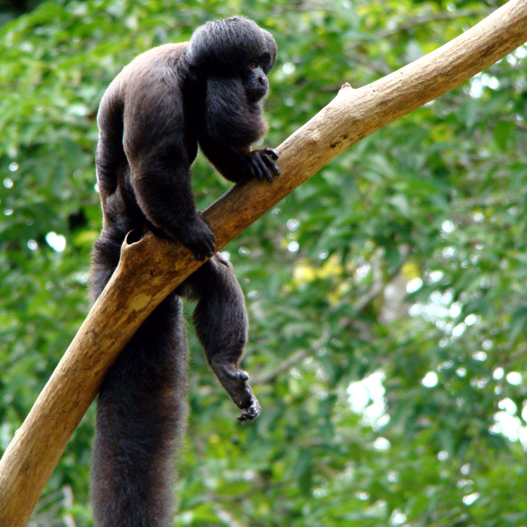
Red-handed Howler Monkey (Alouatta belzebul epiphenotype discolor) Vulnerable
Lowland Tapir (Tapirus terrestris) Vulnerable
White-lipped Peccary (Tayassu pecari) Vulnerable
Giant Armadillo (Priodontes maximus) Vulnerable
Hyacinth Macaw (Anodorhynchus hyacinthinus) Vulnerable
Bare-faced Currassow (Crax fasciolata) Vulnerable
Jaguar (Panthera onca) Near Threatened
Bush Dog (Speothos venaticus) Near Threatened
Neotropical Otter (Lutra longicaudis) Near Threatened
Blue-winged Macaw (Ara maracana) Near Threatened
Chestnut-throated Spinetail (Synallaxis cherriei) Near Threatened


Against all odds
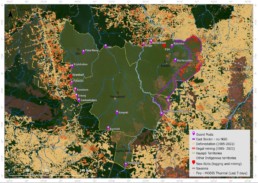
The map below reveals the state of the 10.6 million hectare block of ratified Kayapo Indigenous territory in January 2022. Kayapo indigenous territories are outlined in yellow (NGO Kayapo project territory) with an eastern band of ~ 1.2 million hectares outlined in purple (does not form part of this project) that receives no conservation NGO investment and has been lost to the frontier of illegal activity (logging and mining). Kayapo Guard Posts are marked in purple.
Saving the Horned Curassow: Conservation in Bolivia
An ambitious goal: Saving Bolivia’s Most Endangered Bird
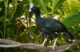
The Critically Endangered and endemic Horned Curassow (Pauxi unicornis) is losing its habitat at an alarming rate, and without direct conservation actions could be the first bird to go extinct in Bolivia.
A powerful partnership: Armonía’s Work with Yuracaré People
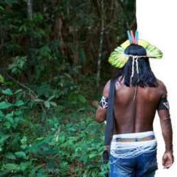
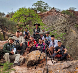
In 2021, our field partner Armonía identified two critical habitats for the Horned Curassow within the TIPNIS, a vast protected area in Bolivia. Using camera traps, they documented 17 individuals across 10 locations — proof that a viable population still survives deep within Yuracaré Indigenous territory. To build a foundation for long-term protection, Armonía engaged directly with the Yuracaré people, conducting in-depth socio-economic research to understand their development needs and how conservation can align with their vision for the future. This is the only region in Bolivia where Indigenous communities have both legal and territorial authority within a national park — making their leadership essential to saving this species from extinction.
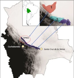
Map: The blue area indicates the known Horned Curassow distribution in Bolivia. Light gray indicates lowlands and black the highlands. Red circle indicates the TIPNIS and project focus area. The Critically Endangered and Bolivian endemic Horned Curassow (Pauxi unicornis) occurs in undisturbed foothill forest between 400 to 1,400 m.a.s.l. This species is found within the TIPNIS (1), Carrasco (2) and Amboró (3) National Park though its habitat is heavily affected by illegal coca agriculture and human invasion. Only the TIPNIS National Park has Yurucaré indigenous territories.
Foothill forest habitat at Isiboro Sécure Indigenous Territory and National Park. Ruth Marquez
🌿 Horned Curassow Conservation Through Birdwatching Tourism
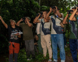
That’s why our partners are working hand-in-hand with Yuracaré communities to build a sustainable birdwatching tourism model that benefits both people and wildlife. At the heart of this effort is a newly developed observation trail in Secejsamma, where confirmed sightings have proven the species still survives. Guided tours, planned for launch in 2025, are designed to empower the community economically while maintaining low-impact, conservation-friendly standards.
More than protection — an opportunity
To bring this vision to life, the project is training Yuracaré guides in advanced birdwatching techniques, strengthening a community tourism committee, and improving infrastructure with a functional basecamp for overnight visitors. A pilot birding trip will help fine-tune the experience and prepare the trail for promotion to national and international birdwatchers. By turning the Horned Curassow into a flagship species for ecotourism, we aim to create a model where conservation and local livelihoods thrive together.
Our outstanding field partners - Asociación Armonia
Asociación Armonía is a Bolivian accredited non-profit conservation organization created in 1993. It is supported by the regional governments of Beni and Santa Cruz and the Bolivian national park administration (SERNAP). In 2009, Armonía received a certificate of commendation from the Bolivian government for its efforts to protect Bolivia’s birds and their habitats. Armonía manages twenty conservation programs, including twelve programs with threatened species.

Join hands with our project field partner Asociación Armonía in protecting the Horned Curassow and all the other species thriving under the stewardship of the Yuracaré people