Protecting Vietnam’s Critically Endangered Turtles
The Turtles We’re Fighting to Protect
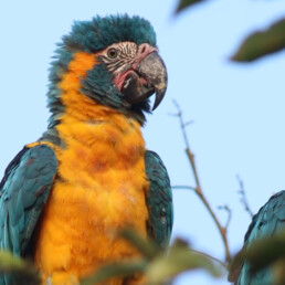
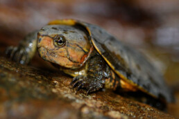
Southern Vietnamese box turtle
Cuora picturata

Endemic to a small region in south-central Vietnam, Cuora picturata is one of the world’s most visually stunning and biologically unique turtles. With its intricately patterned shell and brightly colored head, it is highly sought after in the illegal wildlife trade—both for collectors and for use in traditional medicine.
Status: Critically Endangered
Big-Headed Turtle
Platysternon megacephalum
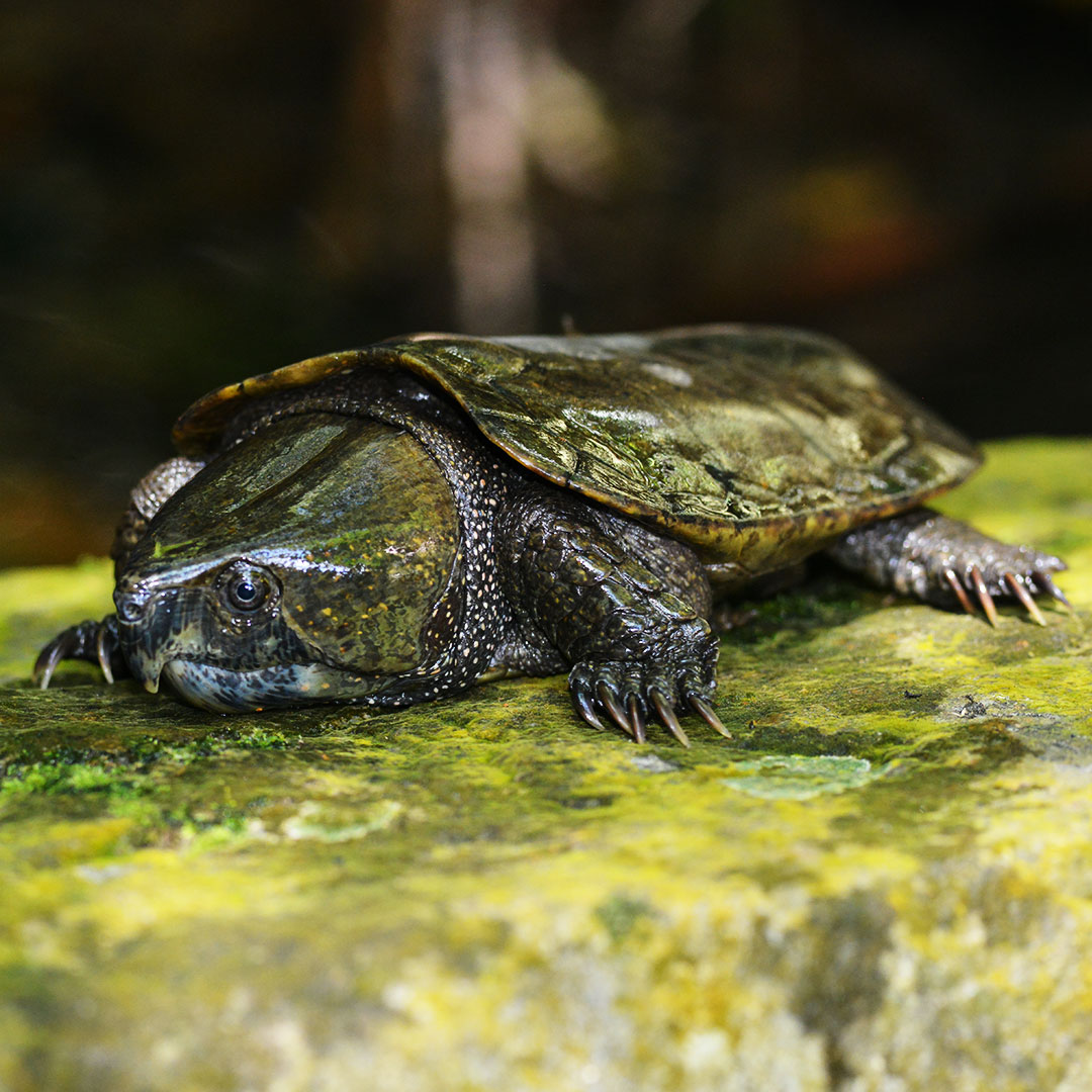
With its disproportionately large head and long armored tail, this ancient-looking turtle is one of Vietnam’s most distinctive reptiles. It prefers cool, fast-flowing mountain streams—habitats increasingly threatened by development and illegal collection. Though rarely seen, its presence signals the health of the forest’s waterways.
Status: Endangered
Four-eyed turtle
Sacalia quadriocellata
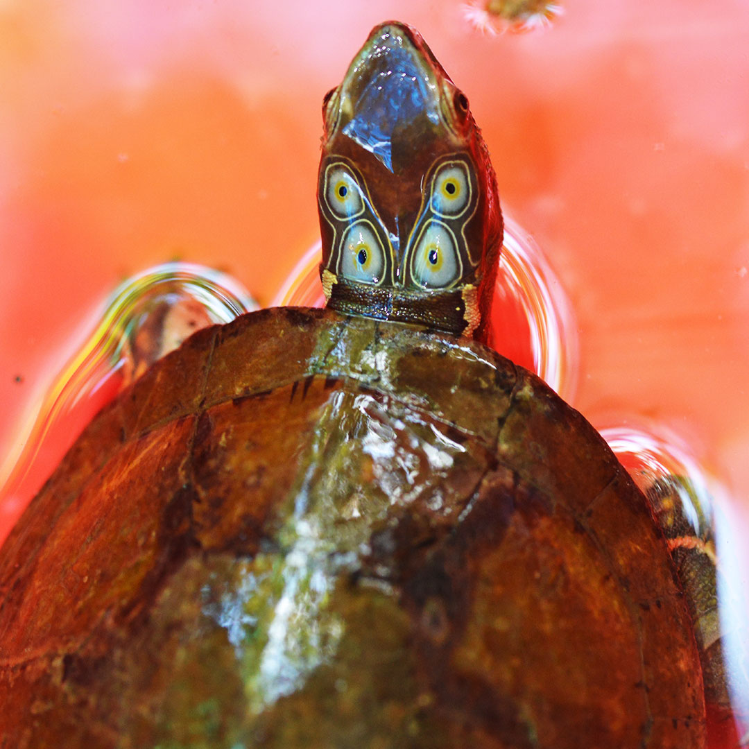
With four bright ‘eye spots’ on the back of its head, Sacalia quadriocellata has one of the most distinctive faces in the turtle world. These markings are thought to confuse predators—but they haven’t protected this species from the threats of illegal trade and habitat destruction.
Status: Endangered
Indochinese Keeled Box Turtle
Cuora mouhotii obsti
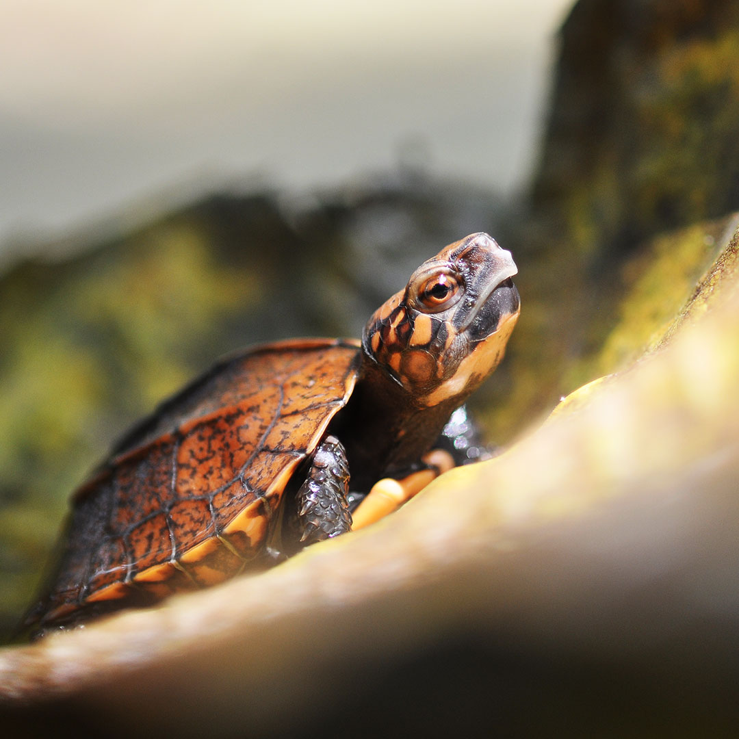
This rugged-looking forest turtle is named for the three sharp ridges—or keels—that run down its high-domed shell. Though less colorful than some of its relatives, Cuora mouhotii obsti is no less threatened. It is frequently caught in snares or collected for the illegal pet and food trade. Like many terrestrial turtles, it reproduces slowly, making population recovery especially difficult once numbers decline.
Status: Endangered
A Forest Silenced by Snares
🪤 12 Million Snares Across Indochina
Conservationists estimate that more than 12 million wire snares have been set across the forests of Indochina. These simple but deadly traps indiscriminately catch any animal that passes—including endangered turtles, pangolins, civets, and primates.
🌲 Empty Forest Syndrome
Even in places where the forest canopy appears lush and intact, the ground below can be eerily silent. Decades of unsustainable hunting and trapping have emptied these ecosystems of the wildlife that once kept them alive. This phenomenon—known as empty forest syndrome—represents a quiet crisis in biodiversity loss.
🐢 Wildlife Trade Pressures and Turtle-Specific Targeting
Vietnam’s turtles are under extreme pressure from the illegal wildlife trade, which targets them for food, traditional medicine, and the exotic pet market. Species with beautiful markings or unusual features—like the Four-eyed Turtle or Cuora picturata—are especially vulnerable.

Cuora mouhotii caught by trap in Vietnam, photo : Thong Pham Van CTNC
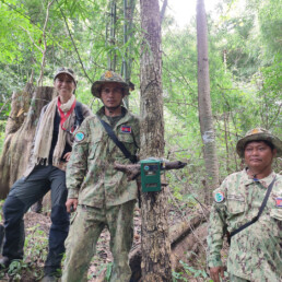
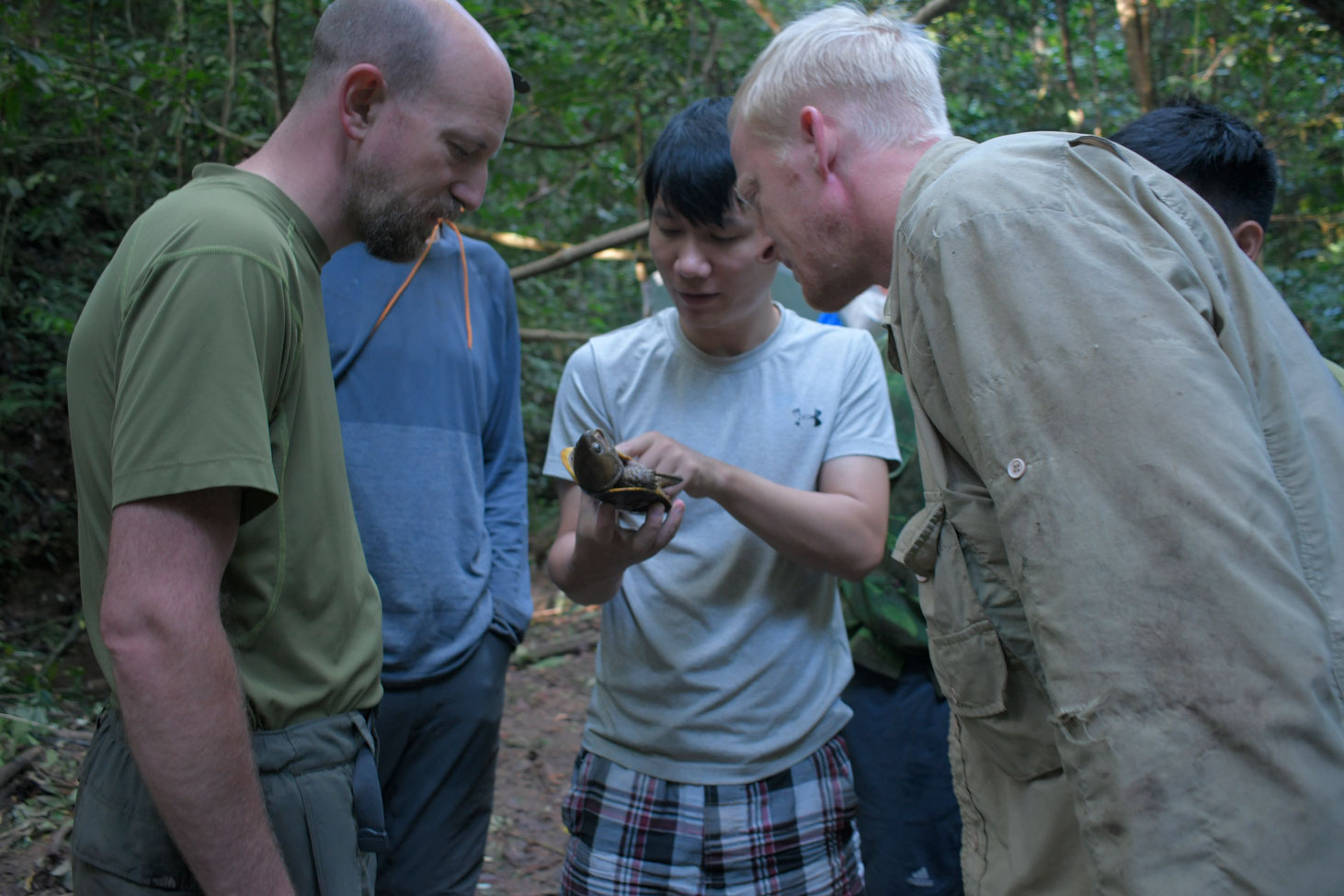
How CTNC Is Leading Turtle Conservation in Vietnam
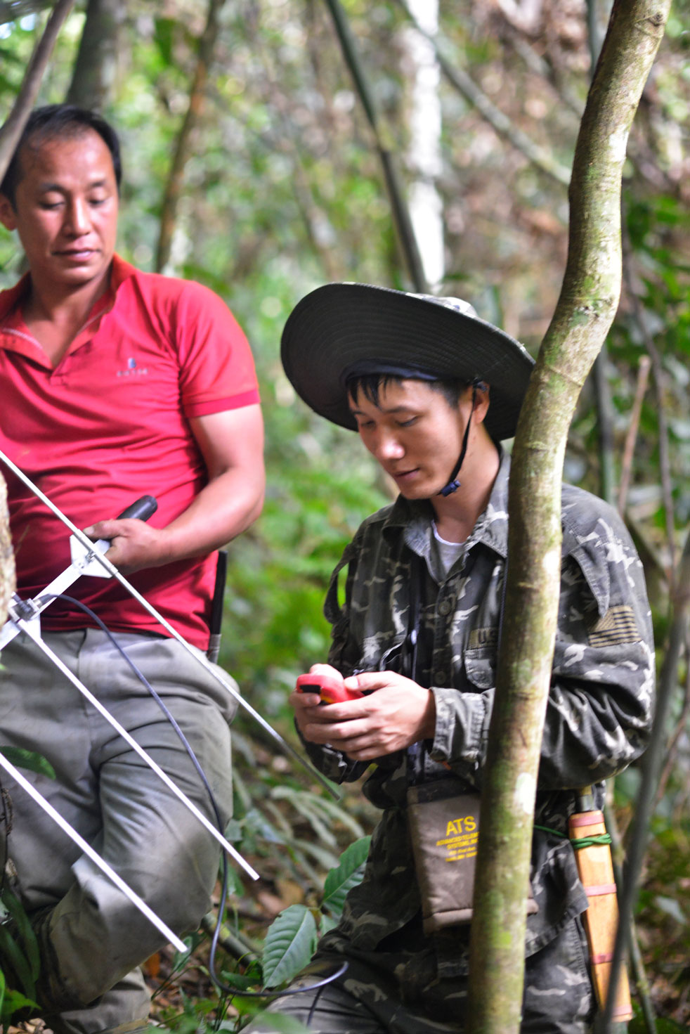
Our field partner – The Center for Technology and Nature Conservation (CTNC) is leading urgent efforts to protect Vietnam’s endangered turtles, including the critically endangered Cuora picturata. Their actions include:
Site protection and snare removal Monitoring and tackling wildlife trade, in collaboration with local authorities in Phu Yen and Khanh Hoa Awareness-raising in local communities Radio tracking for Cuora picturata (we have some funding for this, but still lack the staffing to carry it out fully) SMART training and support for forest officers in Khanh Hoa Province, where most of the Cuora picturata populations remain


“When we found this injured Cuora picturata in a confiscated snare line, she had little chance left. But with quick intervention, she was released back into her habitat. Not all are so lucky.”
Kenya: wildlife conservation at Laikipia Nature Conservancy
Location
Ol Ari Nyiro, Laikipia County, Kenya
Goal
To maintain and enhance conservation at Mukutan Nature Conservancy and connect it with other conservancies in Laikipia County and beyond.
Project Field Partner
The the Gallmann Memorial Foundation is a non-for-profit charitable organization that manages the Mukutan Conservancy in Laikipia County, Kenya.
Size of Area Involved
36,500 hectares (365 km2)


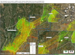
The 365-sq-km Mukutan Conservancy (formerly Laikipia Nature Conservancy; aka Ol Ari Nyiro) on the edge of the Great Rift Valley provides an important sanctuary for wildlife and is a favoured breeding ground for elephants, which migrate from other areas to give birth there. Located on the Eastern wall of the Rift Valley on the Laikipia Plateau, the Conservancy is the most important water catchment area for two major lakes (Bogoria and Baringo). It is part of the Eastern Afromontane Biodiversity Hotspot and harbours an invaluable remnant of the diverse flora and fauna that once covered vast areas of the Laikipia Plateau and the eastern Rift Valley escarpment.
The diverse topography, ranging in elevation from 1260 to 2400 m, supports varied vegetation from dry marginal forests to semi-arid bushland. The reserve is home to the critically endangered wild dog (Lycaon pictus), cheetah, reticulated giraffe, greater kudu, African elephant, a large population of lions, 14 amphibian species, 55 reptiles, 477 birds, more than 800 vascular plants and 755 macro-invertebrates. Of note are two endemic species – a plant (Aloe francombei) and an invertebrate (Aslauga gallmannae) and one frog that is new to science (Tomopterna gallmanni). There is a large remote part of the Conservancy that has not been studied yet, so the species list is expected to increase. The Conservancy provides important migration and wintering habitat to various species and has been designated as an Important Bird Area and a Key Biodiversity Area.


Threats:
- Land Use Change: In Laikipia, cropland has increased by 50%, and settlement has surged by 150% over the past decade. If the benefits derived from wildlife conservation/tourism do not match those of alternative land uses, the expansion of agriculture poses an ongoing threat, primarily fueled by the rising demand to support the growing population.
- Land Degradation: Repeated droughts and poor land-use practices result in overgrazing, soil erosion, and ultimately land degradation. Pasture and water scarcity drive migrant pastoral livestock into protected areas and conservancies.
- Human-Wildlife Conflicts: Elephants and plains wildlife consume or damage nearby crops, while big cats attack and kill livestock. As people seek to protect their property, occasional loss of human or wildlife life occurs.
- Poaching: Subsistence and commercial trade in wildlife products represent significant threats. The proliferation of firearms exacerbates the situation.
- Inadequate Social and Economic Benefits: Wildlife conservation, as a land use, is expected to generate benefits comparable to other land uses. Wildlife tourism and the sale of local products serve as the primary avenues for generating benefits in conservancies. However, the lack of tourism potential or capital investment to effectively engage in enterprises that yield benefits sways local perception negatively.
- Slow Rate of Policy Implementation and Weak Law Enforcement: Effective law enforcement is crucial to ensuring the security of wildlife and its habitats. While commendable efforts have been made by the ranger teams working collaboratively with KWS, there is still much to be done. Adequate funding is essential to carry out their overall responsibility of ensuring wildlife security. Currently, ranger salaries, allowances, transportation, security bases, radios, and other communication equipment are funded by donations, which is not a sustainable approach.
1. Recruiting and training rangers and equipping ranger bases along the border of the Conservancy has improved security dramatically. With increased protection, populations of key species, including elephants, lions, leopards and buffalo, are rebounding. Using real-time data from EarthRanger, a high-tech monitoring system, rangers record patrols, wildlife movements and other activities in real time.
2. With the assistance of the National Drought Management Authority, the Conservancy has negotiated grazing terms with the Pokot, but the northern border needs to be fenced to put it in action. This fencing is underway and when it is completed a system of controlled grazing in the Conservancy during drought conditions can be implemented.
3. An elephant and wildlife corridor between the Conservancy and its closest neighbouring conservancy is unprotected and has been prone to elephant poaching. When the northern fence is complete (it already includes an elephant crossing area), the elephants will be able to traverse this route in safety, assisted and watched by trained Pokot guardians. This is a key part of the strategy to ensure connectivity with the greater Laikipia ecosystem and a current priority.

The professional team of rangers has been instrumental in reducing poaching and illegal grazing.
3. An elephant and wildlife corridor between the Conservancy and its closest neighbouring conservancy is unprotected and has been prone to elephant poaching. When the northern fence is complete (it already includes an elephant crossing area), the elephants will be able to traverse this route in safety, assisted and watched by trained Pokot guardians. This is a key part of the strategy to ensure connectivity with the greater Laikipia ecosystem and a current priority.

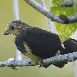
Kenya: Maasai-led conservation of a vulture sanctuary
Location
65 kilometers southwest of Nairobi in the southern Great Rift Valley
Goal
Working with Maasai property owners, a community wildlife sanctuary of 12,600 hectares along a 15-kilometer stretch of cliff habitat favored by breeding vultures and falcons has now been established with a plan to increase its size in the future.
Field Partner
Kenya Bird of Prey Trust’s mission is to secure healthy raptor populations in Kenya. To achieve this they need to protect critical raptor habitats, manage and restore raptor populations and educate people on the value and importance of raptors.
Size of Area Involved
12,600 hectares

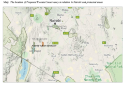
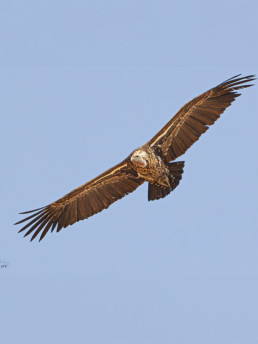
The Kwenia cliffs are approximately 140 meters high overlooking Kwenia Lake in the Rift Valley and serve as in important nesting site for the Critically Endangered Rüppell’s Vulture (Gyps rueppellii). Kwenia is the most important (nesting and roosting) site for this critically endangered species (Gyps rueppellii) in southern Kenya. It serves as the central hub for Rüppell’s Vultures that venture out in search for food across the region. The proposed Kwenia Vulture Sanctuary is favoured by the local Maasai people who recognize that this unique and valuable piece of the Rift Valley is in critical need of protection.

Threats:
- Increased development
- For vultures: poisons found in cattle carcasses and electrocution caused by cement telephone poles
- Resource-based conflicts (overgrazing, commercial agriculture, poison applications, charcoaling, inter-community conflicts)
- Lack of awareness of the value of biodiversity and the need for better policies and planning
- Limited livelihood opportunities and unsustainable livelihoods

The project aims to: establish landowner and community consensus; document land ownership; map the sanctuary; formalize the Kwenia Vulture Sanctuary (KVS); prepare KVS Concept; conduct landowner forum; and register KVS with the Kenya Wildlife Service.
The Kenya Bird of Prey Trust is working with about twenty-five Maasai property owners to establish a wildlife sanctuary of 12,600 hectares along a 15-kilometer stretch of cliff habitat favored by breeding vultures and falcons. The cliffs are approximately 140 meters high overlooking Kwenia Lake in the Rift Valley and serve as in important nesting site for the Critically Endangered Rüppell’s Vulture (Gyps rueppellii). In the first year of the project the KBPT assisted the Maasai to establish agreements among the property owners who have volunteered to establish this Conservancy with the Kenya Wildlife Service.
This unique project is establishing new approaches to reducing the current threats to the vultures and other birds of prey associated with poisons found in cattle carcasses and electrocution caused by cement telephone poles, among other problems. Ultimately, a vulture restaraunt may be developed from clean dead cattle to mitigate the exposure of these vultures to the toxic carcasses available within their foraging range.

Supporting the Kenya Bird of Prey Trust is crucial in ensuring the preservation of healthy raptor populations in Kenya. By backing this field partner, you contribute directly to the protection of critical raptor habitats.
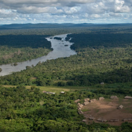
Brazil Jurua
Goal
Conservation success within tropical forest is dependent on the alignment between science, local ecological knowledge and engagement of indigenous people and local communities. This project will strengthen and expand the community-based protection of fluvial beaches and floodplain lakes, to ensure the conservation of the aquatic biodiversity. Beyond the conservation outcomes, this project will also ensure capacity building for indigenous people and local communities which are the main actors ofthe Amazon conservation.

Field Partner
Instituto Juruá is a Brazilian non-profit organization formed by conservationists, researchers and local environmental leaders in close partnership with rural communities and local associations. They provide financial and technical support for community-based initiatives of natural resource management, and offer capacity building opportunities for local communities to help them sustainably manage their natural resources and protect their territory. Their mission is to combine cutting-edge scientific research and traditional local knowledge to support positive initiatives for the use and management of natural resources across the Amazon, in order to promote biodiversity conservation, food security, health and income for indigenous and non-indigenous people.
Location
Jurua River in the Brazilian Amazon. This project will target 20 new floodplain lakes and 20 fluvial beaches. Eventually the model will operate in ~2,500 km of Jurua River, integrating local communities from different levels of local governance. This arrangement will ensure the protection of ~300 floodplains lakes and ~45 fluvial beaches.


Maps data © 2024 Google

It is hoped that this model of river basin conservation program in Amazonia that can ensure the alignment of biodiversity protection and improvements of local well-being will be expanded to other river-basins across the Brazilian Amazonia.
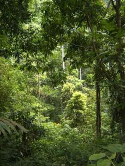
The pulse of the river
The Juruá River is arguably the most meandering tributary of the Amazon River, and irrigates one of the most complex floodplain systems on Earth. It is ~3,500 km long within Brazil alone, and its floodplain features are highly complex with thousands of an astonishing floodplain várzea channels (= paranãs) linking both aging and recent oxbow lakes, which support hugely important freshwater fisheries for both local communities and a high biomass of piscivorous vertebrates. The Juruá region comprises vast expanses of seasonally flooded (várzea, VZ) forest along the floodplain of the Juruá river and adjacent terra firme (TF) forest farther inland. Located within a megadiverse region of Western Brazilian Amazonia, the project area provides key habitats for many species of terrestrial fauna which make regular seasonal incursions into várzea forest from the adjacent terra firme forest to take advantage of abundant plant resources provided by the spectacular annual flood pulse.


Life on the River's Edge
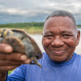
Sand beaches along the main course of the river ensure the reproduction of many important threatened or otherwise historically overexploited species, including freshwater turtles such as the South American River Turtle, Yellow-spotted River Turtle, and Six-tubercled Amazon River Turtle. These fluvial beaches also support important breeding populations of several key migratory waterbird species, including the Orinoco Goose, Black Skimmer, Large-Billed Tern and other transcontinental migrants such as sandpipers and Osprey. The many oxbow lakes in the prospective project area provide critical habitat for the reproduction of several key fish species including pirarucu and feeding sites for turtle hatchlings as well as numerous waterbirds. Other large aquatic vertebrates that will be protected by our project area include Black Caiman, Amazonian Manatee, Giant Otter, and Amazon river dolphin.
The Remarkable Recovery of Arapaima Gigas Population
Contrary to the doom-and-gloom narrative in conservation science, the Jurua is scene to some promising community-based conservation (CBC) arrangements, where local people play a positive role in biodiversity conservation. CBC initiatives are emerging as a powerful tool to recover and maintain populations of several historically overexploited species throughout the Amazon basin, including Arapaima and Freshwater Turtles.
Instituto Juruá’s previous research has helped develop a highly successful initiative integrating both conservation and local livelihoods through a community-based fishery management (CBFM) scheme targeting the giant arapaima (Arapaima gigas). The arapaima is the world’s largest scaled freshwater fish and was dramatically overfished in the last century, but now there is strong evidence for population recovery within CBFM areas, especially in the Juruá River catchment. In this management model, local communities are legally empowered to protect their fishing grounds (oxbow lakes) against large-scale commercial fisheries through an official document called a “Fishing Agreement”. During the dry season, oxbow lakes are discrete units in the landscapes and can be monopolized.
Fishing Agreements effectively secure the establishment of three categories of lake management:
- Open access lakes are available for exploitation by commercial fisheries that are generally uncontrolled;
- Subsistence-use lakes allow access only for fisherfolk from the community directly responsible for the lake — the main purpose of this category is to supply food for the community;
- Strictly protected lakes are ‘no-take’ lakes designed to ensure the reproduction of the target species. Fisheries are not permitted, apart from a sustainable off-take during a short period once each year based on a strict harvest quota. Adapted to hypoxic environments, arapaima regularly come to the surface to breathe, which facilitates direct population counts and stock assessments to set sustainable harvest quotas. These lakes are guarded by the local community over the entire year.
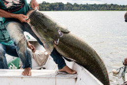
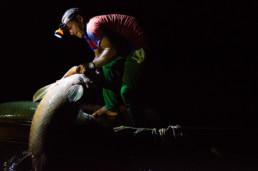
Arapaima gigas, also known as pirarucu

Previous dry-season surveys show that protected lakes contain an arapaima population up to 50-fold higher than in unprotected lakes, and over the last 12 years, wild arapaima populations have
demonstrated an impressive recovery trend, increasing by 425%. During the wet season, when the floodplains are inundated, arapaima can migrate across the landscape, but they return to protected lakes in the dry season, showing high site fidelity. In addition to the conservation benefits for this iconic Amazonian fish, arapaima management has also emerged as a great window of opportunity to improve the welfare of rural people. Sale of sustainably harvested fish from protected lakes provides an average revenue of US$ 9,000/year per lake and these funds have been used to improve access to health and education and to re-invest in infrastructure for further development of the management programme. This has encouraged enthusiastic participation by entire communities, including women, fostered cooperation between remote rural communities, and strengthened regional associations. Due to its strong social and ecological outcomes and its potential to be replicated, the CBFM of giant arapaima has been increasingly recognized as one of the most promising sustainable activities to tackle conservation, food security and poverty across Amazonia.
Landing for transportation to the pirarucu loading port managed at Lake Serrado
Bridging Conservation and Livelihoods
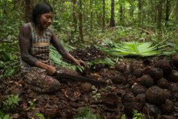
In the same geographic area, community-based conservation of freshwater turtles is also ensuring the population recovery of the Giant River Turtle, which increased over nine-fold during the last 40 yrs. The community-protection of fluvial sand beaches also benefit a wide range of other beach-nesting freshwater species, including migratory and resident birds, catfishes, green iguanas and invertebrates. However, this ICDP model still lacks tangible socioeconomic benefits, and the creation of innovative mechanisms to deliver direct or indirect financial compensation for local beach guards, who protect fluvial beaches (on a 24-by-7 basis) during the nesting season. CBC initiatives therefore provide a source of optimism for the protection of threatened Amazon floodplains and their charismatic megafauna, but it still needs a solid strategy to be strengthened and expanded. In this proposal we bring a set of activities to inform and support the expansion of community-based protection for fluvial beaches and floodplain lakes across ~2,000 km along the Juruá River, which can provide a flagship example for the first basin-wide conservation model led by local communities. Our proposal is based on two complementary pillars: Territorial protection and capacity building of indigenous people and local communities.
Unrecognized and Vulnerable: Challenges Facing the Kulina
The Kulina people belong to the Arawá linguistic family and, until the arrival of the colonizers, were one of the most numerous groups in the state of Acre and southern Amazonas. Their self denomination is madija which means “those who are people”;, with colonizers generally addressed as Cariás. The first regular contacts of the Kulina with the colonizers took place with the rubber tappers in the rubber boom at the end of the 19th century, when they lived deep in the forest. Due to the violent incursions promoted by Brazilian rubber tappers, they fled towards the headwaters of rivers in the region. At Juruá river, the Kulina people from Eré river, a tributary of Juruá River, are a very neglected people who still do not have their territory recognized as an indigenous land. The lack of territory recognition induces a
wide range of conflicts in their lands due to illegal fisheries, hunting and poaching activities. Last year Instituto Juruá started to work with this group by strengthening their social organization towards an official recognition of their territory.
Peru: Rewilding of Spectacled Bear habitat
Location
Challabamba & Kosñipata district, Paucartambo province, Cusco Department, Peru
Goal
To restore and rewild the upper limits of Amazonian cloud forests and learn more about spectacled bears there
Project Field Partner
Conservación Amazónica (ACCA) are a Peruvian non-profit organization that has been working since 1999 on the conservation and enhancement of the Amazonian forests. They create sustainable alternatives for local populations, based on science, technology, and innovation. They are pioneers in protecting the biological diversity of one of the planet’s richest areas: the Amazonian Andes of Peru.
Size of Area Involved
9,119 hectares
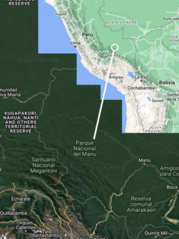
Climate Change Adaptation
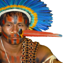
The vast scale of Manú National Park—spanning Andean highlands, cloud forest and lowland Amazonian fortest—makes it a stronghold for apex predators and species with large home ranges or that are rare and widely distributed. The elevational range of Manú, from 300 feet to 11,000 feet above sea level, enhances its importance for the ability of species to adapt to climate change. The spectacled bear (‘Ukuku’ in Quechua) is a cultural icon for the Quechua indigenous people because its movements replicate the seasonal migrations of the ancestral Quechua and traditional groups like the Keros Quechua, who migrate with the seasons to move crops and livestock into different life zones. These highly arboreal bears are one of the few large mammal species to move freely from cloud forest to upper elevation grasslands and thus may play an important role in seed dispersal. The species is designated as Vulnerable and its population is decreasing.

Threats:
The main threats to the highest cloud forest in the Amazon basin are overgrazing and burning from above and an upward shift in plant community assemblages from below.
Restoring Harmony
The project combines engagement with local communities—to restore and rewild degraded areas in the upper limits of Amazonian cloud forests—with a study to understand the movements and diet of bears and their role in plant dispersal. Project highlights include:
- Installation of 96 camera traps in 2022 to better understand the seasonal movements of spectacled bears between habitats—from lowland rainforest to the Andean Puna grassland. The camera traps were placed every 50m of elevation, along an altitudinal gradient of 550-3950 meters above sea level (masl). In total 12,650 wildlife images were processed, including 137 independent spectacled bear detections. ACCA project staff also recorded 17 new individuals, including three mothers with cubs. To date, 37 bears have been identified in the project area.
- Successful propagation of 24 native tree species and production of more than 125,644 seedlings in 2022. Due to delays in the start of the rainy season, only 50,000 were planted last year. The goal is to plant all the trees produced in the first half of 2023.
- Inauguration of the new ‘Andean Bear Interpretation Center’ near the Wayqecha Biological Station in 2022. The center will play an important role in raising awareness about key species and Andean-Amazonian ecosystems, as well as, connecting visitors with science and nature through illustrations, sculptures, photographs, and videos. In total, 350 people were taught at the interpretation center in 2022.


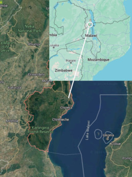
Malawi
Location
Salima District, Malawi
Goal
Following a model that succeeded in neighboring districts, this project will empower communities to protect Lake Malawi’s endangered and economically important fish through Fish Conservation Committees.
Project Field Partner
Ripple Africa is a charity registered in both the UK and the USA, working to improve the environment and local education in Malawi, Africa. The charity was founded in 2003 by Geoff and Liz Furber who both share a passion for Africa, especially northern Malawi.
Maps data © 2024 Google
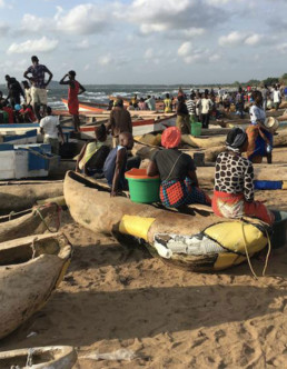
Lake Malawi is the world’s ninth largest freshwater lake and a biodiversity hotspot with more species of fish than any other lake in the world. Of its approximately 1000 species, 90% are endemic. The Lake’s fish are an important food source for millions and yet three of the four species of “Chambo,” the most important food fish, are critically endangered.
Threats:
Lake Malawi’s fisheries have become over-exploited and the response of fishermen has been to increase effort, using longer nets with smaller mesh sizes (including mosquito nets). Fish are caught before they have a chance to grow and breed and many fish are now classified as endangered or vulnerable on the IUCN Red List. The problem has been exacerbated by a lack of government funds to enforce fishing regulations. As the Lake’s fish are a key source of animal protein for the country’s most vulnerable groups, this has serious nutritional implications. Declining species richness has implications for the resilience and productivity of Lake Malawi’s fisheries, as well as for the overall health of the lake ecosystem.
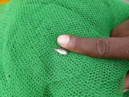
Baby Chambo fish caught in a mosquito net.
The project focuses on Oreochromis lidole (known locally as Chambo) but also benefits other species. By protecting breeding areas and banning fishing with mosquito nets, Beach Village Committees ensure there is increased plant growth providing more protection for baby fish. Young Chambo are be able to grow larger and breed. This helps increase stocks of Chambo and other fish. The project also encourages the use of larger meshed nets to catch larger Usipa — a sardine-like fish — and Utaka.
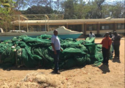
Confiscated mosquito nets used for fishing.
Fishing communities benefit in deriving greater household income from fish catches, which results from healthier and more resilient fish stocks. This provides positive feedback validating the actions taken by the Fish Conservation Committees. Ultimately, the increased number of larger fish available in markets is providing more sustainable animal protein, benefiting many more people in Malawi.
Mosquito nets being used in a fish breeding area.

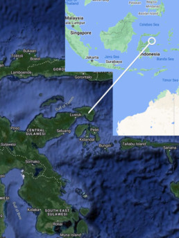
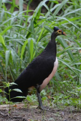
Indonesia: Securing a future for imperilled wildlife in Sulawesi
Location
Sulawesi, Indonesia (mainly Tompotika Peninsula)
Goal
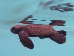
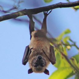
To secure a future for the Endangered Maleo bird and other imperilled wildlife, notably sea turtles, fruit bats, and the Anoa and Babirusa—two of Sulawesi’s most threatened mammals—in the Tompotika area and beyond.
Project Field Partner
The Alliance for Tompotika Conservation (AlTo), is a registered non-profit organization in Indonesia and the USA. The key personnel for this program are AlTo Director Marcy Summers along with AlTo Conservation Officers and villagers.
Size of Area Involved
250,000 hectares (2,500 km2)
Maps data © 2024 Google
Compared to its neighbours, for example Borneo and Sumatra, which both host charismatic megafauna like orangutans, tigers, and elephants, Sulawesi gets very little research or conservation attention, but the minute you look closely you realize it’s a conservation treasure, with nearly half its vertebrate species endemic.
— Marcy Summers, Director, AlTo
The Tompotika area, where AlTo’s efforts are focused, represents a centre of endemism within the global “biodiversity hotspot” that is Sulawesi. Recent surveys have identified at least 9 new animal species known only from this area. Tompotika boasts an excellent representation of Sulawesi’s characteristic natural habitats, including montane moist forests, savannah, wetlands, mangroves, sandy beaches, coral reefs, and seagrass beds. Importantly, this project has resulted in the only population of the Critically Endangered Maleo bird that is known to be increasing.

Sulawesi is a worldwide conservation priority. In a study of how scarce resources can be optimally allocated for conservation, Sulawesi emerged as the highest-ranked among the neighbouring conservation priority regions – Sumatra, Borneo, Java/Bali, and southern peninsular Malaysia.
The Tompotika region, rich with karst cave formations providing roosting habitat for various bats, is a hotspot of bat diversity within Sulawesi. Fruit bats play a critical role in maintaining the health of Tompotika’s native tropical forests by pollinating trees, spreading seeds that help forests regrow, and by providing high-quality fertilizer. Many tropical fruit and nut trees, such as mango, cashew, wild banana, avocado, and durian, to name but a few, rely on bats for pollination to produce fruit. In addition, insectivorous bats control populations of insect pests, such as the mosquitos that spread malaria or the grasshoppers that destroy rice crops.
Threats:
Both Maleos and sea turtles have undergone population declines from rampant harvesting of their eggs by local people. Bat populations, which play a vital role in maintaining the health of Tompotika’s native forests, and forest-dwelling anoas and babirusas have also declined under heavy hunting pressure fueled by the demand of expanding bushmeat markets in North Sulawesi. Tompotika’s native forests face threats of illegal logging, conversion for oil palm plantations, slash and burn agriculture, and mining.
Maleo nesting site. Video by Anne Lambert
AlTo is focused on the Tompotika Forest Preserve, a 10,000-hectare protected rainforest area surrounding Mount Tompotika, at the heart of the Tompotika peninsula. This aim is to protect this area from mining, illegal logging, conversion for oil palm plantations, slash and burn agriculture, and other threats, while working with local people to encourage forest-friendly lifestyles and livelihoods, such as organic farming and wild silk-moth rearing, in areas adjacent to the Preserve.
Interactive conservation education programs reach about 1500 school children each month. Focusing on one topic at a time, the programs include presentations, games, printed materials, and take-home items. Thanks to these efforts, most of Tompotika’s 20,000+ school children have now had at least an introduction to local conservation issues.
AlTo staff meet regularly with village leaders and community members to raise awareness about local and regional environmental issues and their efforts to address them. Several successful village-wide events have been organized, including beach cleanups to remove turtle nesting hazards
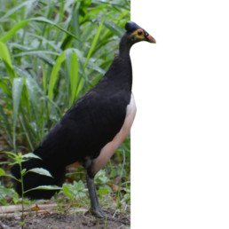
The Maleo: a conservation success story
Guard teams comprising AlTo staff and local villagers have been patrolling the maleo’s communal nesting ground near the village of Taima round the clock to prevent egg collecting and other human-caused disturbances such as logging or livestock pasturing. These efforts have saved thousands of eggs and almost completely eliminated poaching. The Taima nesting ground has become the only site in the world where the maleo population is on the rise: the number of adult maleos returning to nest here has increased from 1312 in 2006 to over 4000 at present. This clearly represents a significant proportion of the global maleo population, estimated at 8,000-14,000 mature birds. AlTo’s Taima site now host far more maleos than any other maleo nesting ground throughout the species range. It is the only one where large numbers of eggs are protected in their natural state and chicks disperse without hatchery intervention.
Recognizing the importance of AlTo’s maleo protection efforts at Taima, in 2014 the Indonesian government officially declared the Taima nesting ground an “essential ecosystem” (this designation has only been awarded to 7 sites nationwide). This will strengthen formal protection for maleos.
In 2014, they began protecting a recently discovered nesting site (Kaumosongi; near Teku/Toweer villages) that is connected to the Taima site by an 18-km stretch of intact forest that represents non-breeding habitat for the maleo. AlTo works with villagers and government to preserve forest adjacent each nesting ground and between them and to address the human-related threats within this corridor (e.g., hunting with dogs). This complex of nesting grounds and high-quality non-breeding habitat represents the first maleo “stronghold” ever effectively protected.
Maleo (Macrocephalon maleo) at Muara Pusian, North Sulawesi photo by Ariefrahman
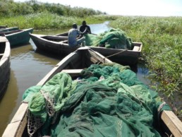
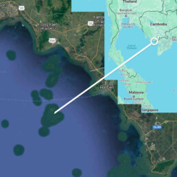
Cambodia: Stop harmful fishing practices to preserve marine ecosystems.
Location
Province of Kep, Cambodia
Goal
Bring about the recovery of severely damaged marine ecosystems, including seagrass beds, coral reefs and fish communities
Project Field Partner
Marine Conservation Cambodia (MCC) is a non-profit organization that advances marine conservation and community livelihoods in collaboration with the Cambodian Fisheries Administration. MCC is making a striking difference on a modest budget.
Size of Area Involved
16,900 hectares (169 km2)
Maps data © 2024 Google
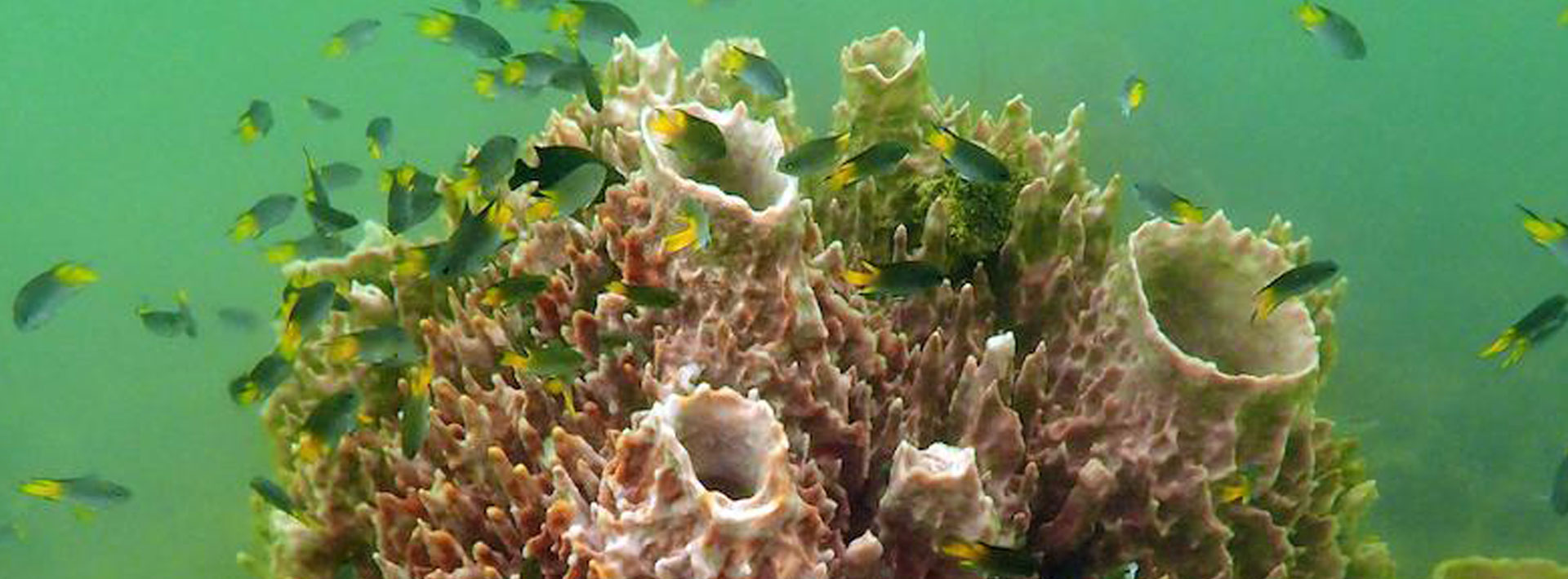
Conservation Value
Seahorses, seagrass beds, coral reefs and a wealth of marine biodiversity in Cambodia need urgent conservation action and this project is showing the way. In April 2019, the Kep Archipelago was declared a Hope Spot by the international nonprofit Mission Blue in recognition of the impact that the conservation efforts of Marine Conservation Cambodia has had in preserving the area’s unique seagrass meadows and sensitive marine species.
Cambodian marine ecosystems and local fishing communities are being destroyed by illegal and destructive fishing practices of large-scale bottom trawling and electric fishing. Protection and enforcement can turn this around. Marine Conservation Cambodia is building on past success in curtailing these practices, allowing marine ecosystems to recover and improving livelihoods for small-scale family fishers.


Actions & Results
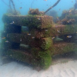
The MCC team passed a milestone in having deployed 270 conservation and Fisheries Production Structures in Cambodian waters. These structures, made from concrete blocks, protect the Kep marine fisheries management area and areas important for marine mammals such as the Irrawaddy dolphin (EN). Fisheries Production Structures which entangle trawl nets, continue to prove highly effective in deterring illegal fishing. This has inspired similar action in neighboring Kampot province where MCC worked with Wild Earth Allies and local fishing communities to deploy these structures.

These concrete anti-trawling devices are low-cost and effective.
In addition, the devices serve as a substrate for many marine organisms including oysters and mussels, thereby boosting opportunities for local fishers. Depending on their size, anti-trawling devices cost just $55 to $140 to make.
Ongoing MCC mapping of seagrass meadows in Kep and Kampot has found 1,202 hectares of seagrass regrowth. Seaweed, corals and bivalves are also recorded. The recovering marine ecosystem offers food and shelter to a diversity of marine life. The MCC Marine Mammal research team were thrilled to witness the return of two emblematic species in Kep and Kampot waters: the Indo-Pacific Humpback Dolphin (aka Pink Dolphin; VU) and the Dugong. Cambodia’s marine life is coming back!


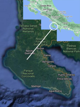
Costa Rica: Preventing Ecosystem Collapse in the Osa Peninsula and beyond
Location
Osa Peninsula, southwest Costa Rica
Goal
To increase ecosystem resilience by restoring apex predator and prey populations and habitat connectivity in the Osa Peninsula.
Project Field Partner
Osa Conservation (OC) is leading a conservation effort that mobilizes citizen scientists, community members, ecotourism operators, park administrators and multiple NGOs to preserve the globally significant biodiversity of the Osa Peninsula in the face of climate change. To accomplish this, connectivity must be re-established from the Osa lowland rainforests to the Talamanca Mountains.
Size of Area Involved
109,300 hectares (1,093 km²)
Maps data © 2024 Google
A biodiversity hotspot
The Osa Peninsula contains the largest mesic rainforest remaining on the Pacific slope of Central America, largely within Corcovado National Park. It has the largest expanse of mangrove wetlands on the Pacific slope of Central America and a unique coastal marine ecosystem—the Golfo Dulce tropical fjord. The Osa is estimated to house 2.5% of the world’s biodiversity while covering less than 0.001% of its total surface area, and was described by National Geographic in 2016 as “the most biological intense place on earth”.
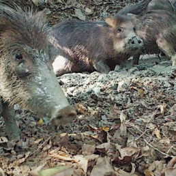
Threats
The main threat in the Osa Peninsula is illegal hunting, which is still prevalent in the region. The concern is greatest with respect to the Lowland Paca (Cuniculus paca), White-lipped Peccary (Tayassu pecari) and Collared Peccary (Pecari tajacu). Other species are hunted to a lesser degree, including game birds such as: Tinamou (Tinamus major and Tinamus major castaneiceps) and Great Curassow (Crax rubra). Research has identified key areas of hunting pressure, however no concerted effort had been been made to reduce illegal hunting on the peninsula. A presentation at the 21st Mesoamerican Congress in San Jose in 2017 revealed that bushmeat offtake could be around 28.5 kg per year for each family hunting in the peninsula.
Rainforest Heroes of the Osa Peninsula, Costa Rica: Tomas Ridings Muñoz
In collaboration with a network of partners and local stakeholders, OC is rebuilding this connectivity via its ‘Ridge to Reef’ initiative to help protect one of the world’s last wild places. In 2022 OC planted 40,000 mangrove trees to restore 40 ha of degraded mangrove forest in the Térraba Sierpe wetlands—the largest protected wetland in Central America. It also planted 81,062 rare, native, and threatened trees species, to connect landscapes so biodiversity can thrive. OC trained 30 volunteer rangers to patrol 69,731 km of forest which generated 27,265 field biodiversity observations. This data was integrated in real time into the first Earth Ranger project in Latin America. It also protected and released 28,272 sea turtle hatchlings—for a total of 208,700 hatchlings released by OC—and collected 1,135 lbs. of garbage from pristine sea turtle nesting beaches with the help of 215 volunteers. To build capacity at the local level and to empower civil responsibility, OC employed 114 local community members through restoration, research, and conservation initiatives, and hosted over 400 community members at the bi-annual Rainforest Heroes Celebration. After its successful inaugural year (2021), OC’s ‘Ridge to Reef Nature Club’ continued to provide rural youth with an immersive nature-based learning model and to raise the next generation of conservation stewards. The Club grew to 9 chapters and engaged 2,521 youth across the Osa region in 2022.

Representation of locations where camera traps, acoustic devices, and soil & dung beetles samples were taken. At all the sites camera traps were set. In a subset acoustics coincide with camera trap locations (red diamond overlapped with black dot), another subset camera trap coincide with dung beetles and soil samples (red diamond overlapped with yellow dot), another subset three data collections were conducted, camera trap, acoustic, dung beetles and soils (red diamond overlapped with yellow and black dots). The communities where social surveys were conducted are named in the map (18 in total).
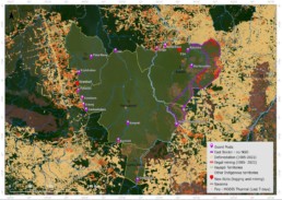
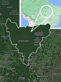
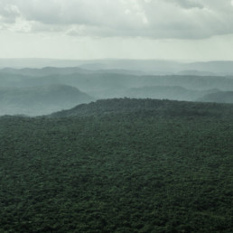
The Kayapo Project
Location
South-East Amazonia, Brazil
Goal
The Kayapo Project is an Indigenous led NGO alliance ensuring Mebêngôkre-Kayapo (Kayapo) cultural, economic, political, and territorial autonomy over more than nine million hectares of federally demarcated Indigenous lands located in the highly threatened southeastern Amazon.
Project Field Partner
ICF partners with three Kayapo NGOs: the Protected Forest Association, Kabu Institute, and Raoni Institute representing communities of the northeast, northwest and southwest sectors of Kayapo territory.
Size of Area Involved
~9 million hectares, 90,000km2. Approximately the size of South Korea, the State of Virginia, 3x the size of Belgium
Maps data © 2024 Google
Kayapo lands conserve the last remaining large, intact block of native forest in the southeastern Amazon, and maintain the connectivity of this ecoregion with the western Amazon. They confer incalculable benefits to protection of biodiversity, mitigation of climate change and preservation of the crucial role of Amazonian forests in producing rainfall over a much larger geographic scale.
Kayapo territories are large enough to protect large scale ecological processes. For example, very large areas are required to maintain tropical tree species because individuals of species are usually very sparsely distributed. Most tropical tree species depend on co-evolved animal vectors for pollination and seed dispersal across large inter-individual distances – small areas do not contain enough individuals or viable animal vector populations for regeneration over the long term. The intricate web of interdependence among Amazonian species requires large areas for these ecosystems to function and persist.
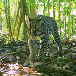
Threatened vertebrate species found in the Xingu protected areas corridor, with IUCN Red List (2016) designation.
Endangered species:
Eastern Amazonian Bearded Saki Monkey (Chiropotes satanas utahicki) Critically Endangered
White-cheeked Spider Monkey (Ateles marginatus) Endangered
Giant Otter (Pteronura brasiliensis) Endangered
Vulnerable or Near Threatened species:
Red-handed Howler Monkey (Alouatta belzebul epiphenotype discolor) Vulnerable
Lowland Tapir (Tapirus terrestris) Vulnerable
White-lipped Peccary (Tayassu pecari) Vulnerable
Giant Armadillo (Priodontes maximus) Vulnerable
Hyacinth Macaw (Anodorhynchus hyacinthinus) Vulnerable
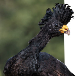
Bare-faced Currassow (Crax fasciolata) Vulnerable
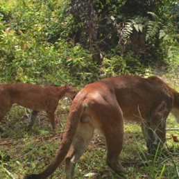
Jaguar (Panthera onca) Near Threatened
Bush Dog (Speothos venaticus) Near Threatened
Neotropical Otter (Lutra longicaudis) Near Threatened
Blue-winged Macaw (Ara maracana) Near Threatened
Chestnut-throated Spinetail (Synallaxis cherriei) Near Threatened


Against all odds
The map below reveals the state of the 10.6 million hectare block of ratified Kayapo Indigenous territory in January 2022. Kayapo indigenous territories are outlined in yellow (NGO Kayapo project territory) with an eastern band of ~ 1.2 million hectares outlined in purple (does not form part of this project) that receives no conservation NGO investment and has been lost to the frontier of illegal activity (logging and mining). Kayapo Guard Posts are marked in purple.