Location

South-East Amazonia, Brazil

Goal

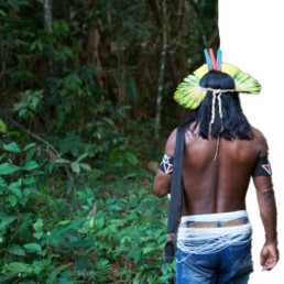
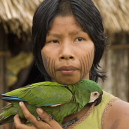
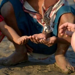
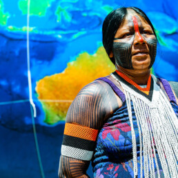
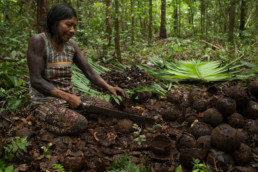
The Kayapo Project is an Indigenous led NGO alliance ensuring Mebêngôkre-Kayapo (Kayapo) cultural, economic, political, and territorial autonomy over more than nine million hectares of federally demarcated Indigenous lands located in the highly threatened southeastern Amazon.

Project Field Partner

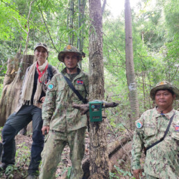
ICF partners with three Kayapo NGOs: the Protected Forest Association, Kabu Institute, and Raoni Institute representing communities of the northeast, northwest and southwest sectors of Kayapo territory.

Size of Area Involved

~9 million hectares, 90,000km2. Approximately the size of South Korea, the State of Virginia, 3x the size of Belgium

Support this Project

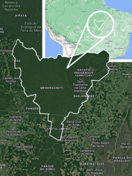
Maps data © 2024 Google

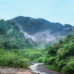
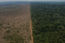
Kayapo lands conserve the last remaining large, intact block of native forest in the southeastern Amazon, and maintain the connectivity of this ecoregion with the western Amazon. They confer incalculable benefits to protection of biodiversity, mitigation of climate change and preservation of the crucial role of Amazonian forests in producing rainfall over a much larger geographic scale.

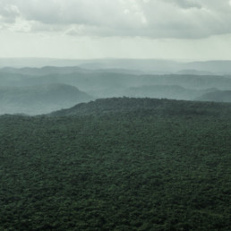
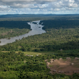
Kayapo territories are large enough to protect large scale ecological processes. For example, very large areas are required to maintain tropical tree species because individuals of species are usually very sparsely distributed. Most tropical tree species depend on co-evolved animal vectors for pollination and seed dispersal across large inter-individual distances – small areas do not contain enough individuals or viable animal vector populations for regeneration over the long term. The intricate web of interdependence among Amazonian species requires large areas for these ecosystems to function and persist.

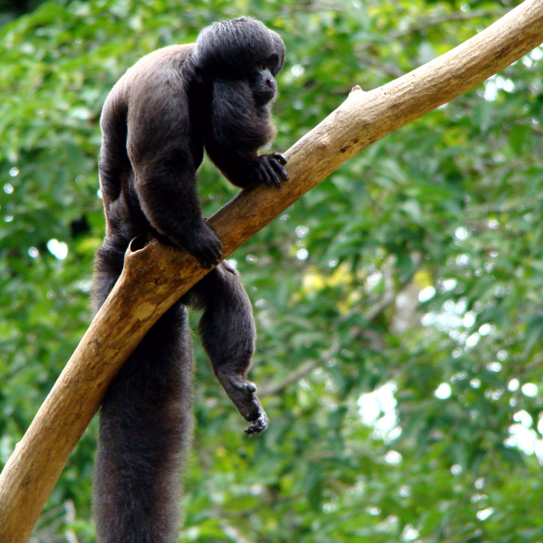
Threatened vertebrate species found in the Xingu protected areas corridor, with IUCN Red List (2016) designation.

Endangered species:

Eastern Amazonian Bearded Saki Monkey (Chiropotes satanas utahicki) Critically Endangered
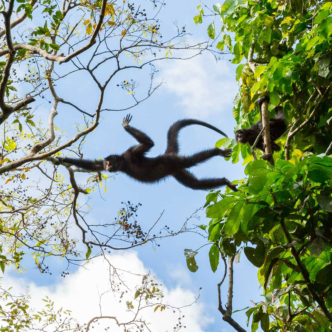
White-cheeked Spider Monkey (Ateles marginatus)   Endangered
Giant Otter (Pteronura brasiliensis)  Endangered

Vulnerable or Near Threatened species:

Red-handed Howler Monkey (Alouatta belzebul epiphenotype discolor)  Vulnerable
Lowland Tapir (Tapirus terrestris)  Vulnerable
White-lipped Peccary (Tayassu pecari)  Vulnerable
Giant Armadillo (Priodontes maximus)  Vulnerable
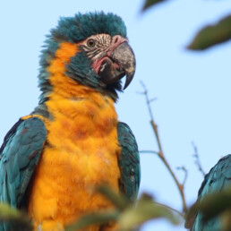
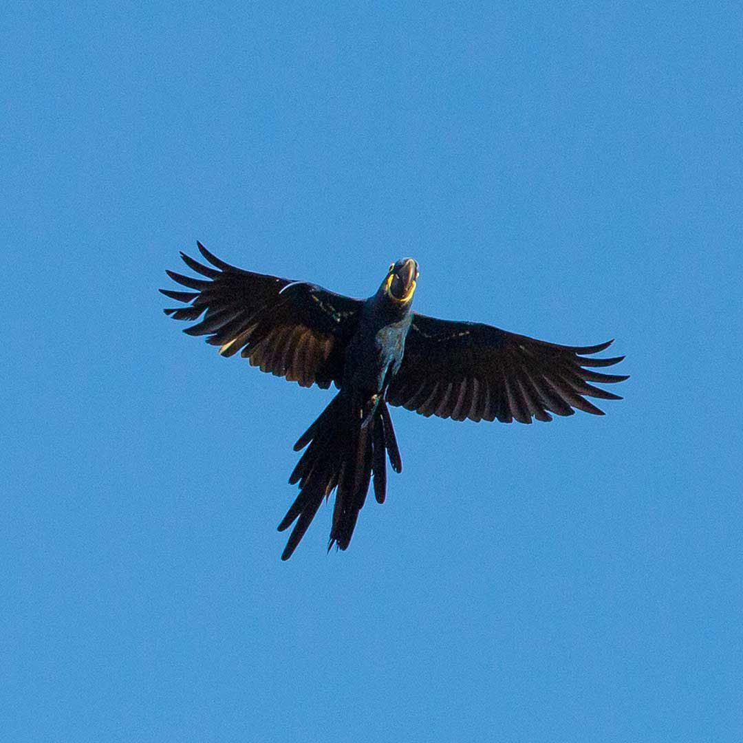
Hyacinth Macaw (Anodorhynchus hyacinthinus)  Vulnerable
Bare-faced Currassow (Crax fasciolataVulnerable
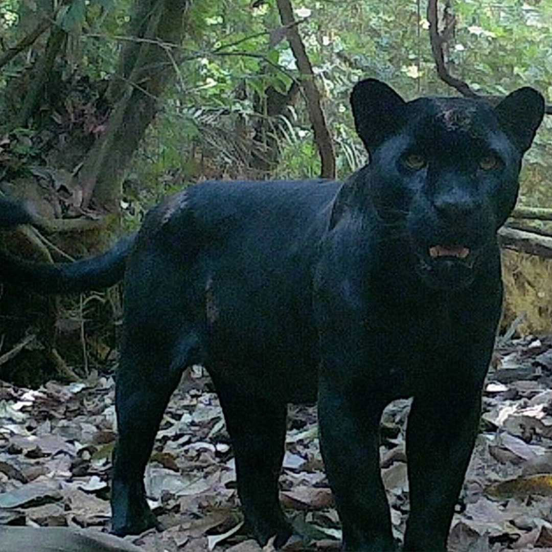
Jaguar (Panthera onca)  Near Threatened
Bush Dog (Speothos venaticus)  Near Threatened
Neotropical Otter (Lutra longicaudis)   Near Threatened
Blue-winged Macaw (Ara maracana)  Near Threatened
Chestnut-throated Spinetail (Synallaxis cherriei)  Near Threatened
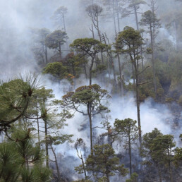
Territorial Surveillance

Guard posts

At the core of the Kayapo’s territorial surveillance program are the guard posts, serving as the cornerstone for the organization’s efforts to monitor and protect their extensive 2,200 km (1,375 miles) of borders, which delineate their protected forested territory from frontier society.

The guard posts play a pivotal role in signaling to external frontier societies that the Kayapo, residing in a particular area, are well-organized and committed to defending their legally recognized land rights. This proactive stance discourages potential invaders from attempting unauthorized entry. Within the guard post program, the intrinsic Kayapo determination to safeguard their territory, culture, and livelihoods merges with access to equitable income, creating a robust social deterrent against the allure and bribery attempts by goldminers, loggers, and fishermen.

The management of fifteen guard posts falls under the responsibility of three Kayapo NGOs: Associação Floresta Protegida, Instituto Kabu, and Instituto Raoni.

Expeditions

On-foot and river expeditions serve as essential complements to guard posts, contributing to the occupation and defense of border sections not yet monitored by a guard post. These expeditions also serve as crucial platforms for the transfer of traditional territorial and cultural knowledge from elders to the youth. Consequently, they offer training in both traditional and modern territorial surveillance techniques while instilling a sense of Kayapo pride.

Sustainable Income

Brazil Nut and Cumaru Harvest

The Brazil nut is a perfect blueprint for sustainable development: it can only be harvested from primary forest and generates sustainable and equitably distributed income for the communities that protect it. The defense of the forest, the well-being of the people, and the preservation of their culture are linked to a single economic activity. That’s sustainability in a nutshell!

These delicious and nourishing nuts contribute to a fairly distributed annual income for Kayapo communities. Families or individuals have the option to gather and sell these nuts, aligning seamlessly with Kayapo culture and worldview as it has been a longstanding practice among them. Annually, during the fruiting season of the Brazil nut tree, which occurs from December to March in the rainy season, Kayapo families disperse throughout the forest, establishing camps near clusters of towering Brazil nut trees.

Kayapo Brazil nut and cumaru seed enterprises are examples that demonstrate sustainable income generation for forest communities is possible.

Sportfishing

Thanks to a collaboration involving Associacao Floresta Protegida, Untamed Angling, and various Kayapo communities, individuals can now explore the rainforest in a manner that honors the environment and treats the indigenous hosts fairly. The sportfishing initiative emphasizes the importance of a transparent and equitable partnership with the indigenous landowners.

Field course

The Kayapo internship initiative provides a distinctive chance to gain knowledge and collaborate with the Kayapo People of A’Ukre, alongside their network of NGOs, universities, and government collaborators. Participants have the opportunity to visit the A’Ukre community and the Pinkaiti Ecological Research Station, gaining insights into life at the Amazonian frontier. The funds generated through the program are directed towards investments in the A’Ukre community.

Against all odds

The Kayapo have successfully defended their land from the relentless attacks of frontier society. The resilience of the Kayapo-NGO alliance can be observed from space, as satellite images reveal virtually no deforestation amidst a sea of agricultural expansion and gold mining.

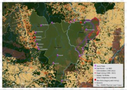
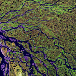
The map below reveals the state of the 10.6 million hectare block of ratified Kayapo Indigenous territory in January 2022. Kayapo indigenous territories are outlined in yellow (NGO Kayapo project territory) with an eastern band of ~ 1.2 million hectares outlined in purple (does not form part of this project) that receives no conservation NGO investment and has been lost to the frontier of illegal activity (logging and mining). Kayapo Guard Posts are marked in purple.

Support this Project

Photo : Martin Schoeller

Join hands with the Kayapo People in their efforts to defend 9 million hectares of pristine rainforest in the South-East Amazon rainforest.